
Deforestation has left scars in the mountainous corridor of Ecuador’s provinces bordering Peru. But in a village of paramo and montane forest, residents are giving nature a respite by protecting their micro forests.
In the San Andres Valley, it used to rain continuously for fifteen days, without the sun’s rays ever breaking through the clouds.
“It seemed like the roof was falling in. It was scary,” recalls 80-year-old Esther Guerrero as she sits in her modest house in the lower part of the valley. Steam from a pot of coffee rises to the tin roof, filing the room with a haze that makes her story seems like a journey through time.
But the climate she remembers has changed forever in this part of Ecuador’s eastern province of Zamora Chinchipe bordering Peru. “Now it rains very little,” says the octogenarian. She attributes the change to the valley’s colonizers and their “hunger” for timber and land.
Esther Guerrero, 80, and her daughter Marisol decided to conserve about 150 acres of forest to create an ecotourism corridor, despite the challenges of unemployment and a weak economy.
The people in the San Andres Valley have changed their way of thinking about their mountains as climate change has changed their way of life. To protect their micro forests, they are taking conservation into their own hands.
Dozens of farmers such as Guerrero and her daughter Marisol, and Wilman Jimenez and Jose Jimenez, have decided to fence their land to preserve their patches of forest and to continue to bring rain to the mountains. The rainwater flows down the tree trunks, filters through the moss and soil and finally reaches the Isimanchi River, which feeds the Chinchipe River that crosses the border and irrigates the Peruvian departments of Piura, Cajamarca and Amazonas.
"When there is someone who takes care, people are respectful," says 81-year-old Jose Jimenez, as he talks about the role of community members in the protection of the ecosystem. As he guides us along a dirt road that cuts through a stream, he tells us that for the past 15 years he has been preserving 75 acres of forest which he owns on a mountain that rises behind his house.
As recently as a decade ago, Jimenez raised cattle and once a month moved livestock 276 miles from San Andres to Guayaquil. The business stopped being profitable and he decided to live a quieter life, although his only source of income comes from the rental of a few rooms and the management of a small grocery store.
Jimenez was also president of the Parish Council of San Andres, a form of local government, between 2007 and 2009. In that last year, the community decided to seek help in the face of the evident damage of deforestation and climate change. They knocked on the door of the organization Nature and Culture International (NCI) and the municipality of Chinchipe.
NCI provided them with technical assistance in 2009 to prepare studies and reports and the municipality promoted the creation of the San Andres Municipal Conservation Area in 2010. Since 2010, almost 12,000 acres have been preserved under the protected status. But those were only the first steps.
José Jiménez, 81, stands with his back to acres of forest that belong to him on a mountain near his home in San Andres.PHOTO: Jonathan Palma
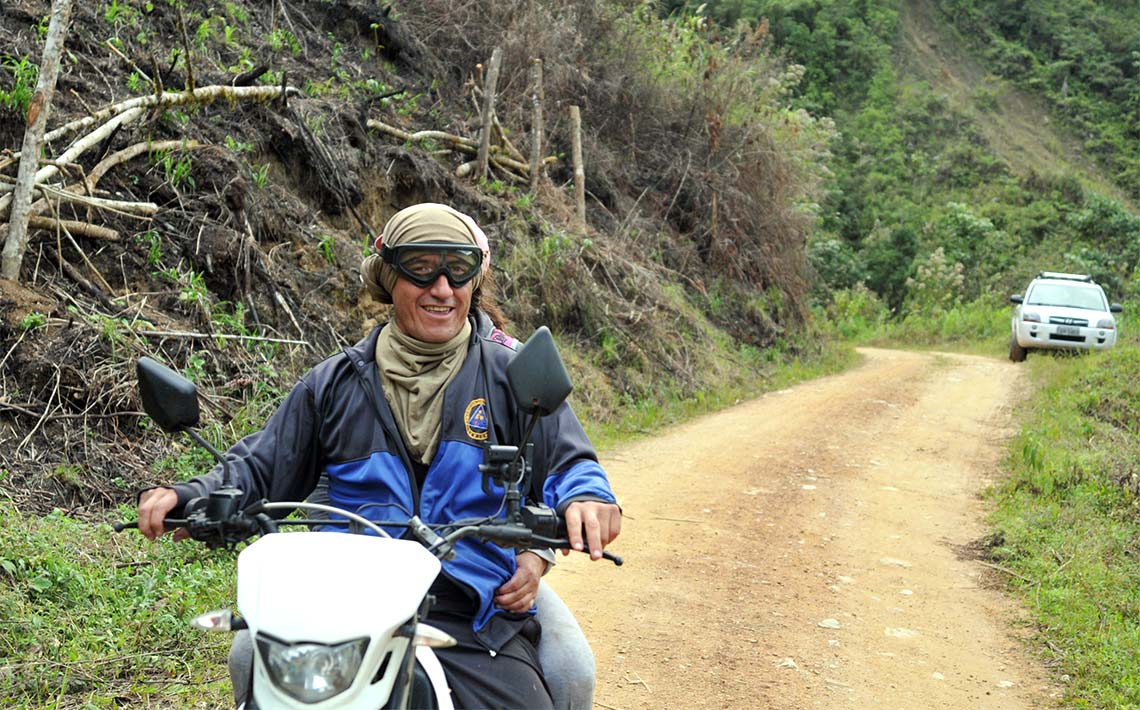
The San Andres Valley is about 17 hours by land from the port city of Guayaquil, the second most important city in Ecuador after Quito. As the distance between the city and the rural valley increases, the road changes from pavement to asphalt and then from asphalt to dirt. The final three-hour stretch is made on trucks and rancheras (trucks that have been converted to buses) that wind along mountain roads just thirteen feet wide.
Maria Jimenez is traveling on one of them on her way to Los Rubí, a hamlet in the middle of the route. The fog at times hides the depth of the abyss, which can be seen from both sides of the vehicle. The altitude of the highest mountains in the province is almost 10,000 feet above sea level.
Scars caused by deforestation mark the road that leads to the San Andres Valley. There are traces of burning vegetation, evidence of the practice of clearing land with fires to plant crops or extend the pasture for livestock.
On the road that connects the provinces of Loja and Zamora, trucks carrying huge logs are a common sight. There are sawmills on the side of the road.
"Many finqueros (mountain dwellers) have cut down the trees. Few of the larger trees are left. There they make livestock buildings," says Jimenez.
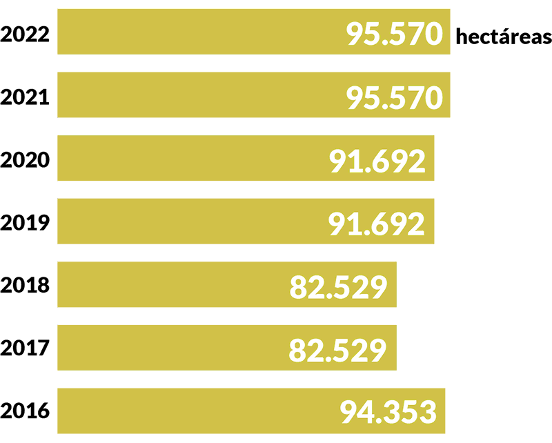
A review of Ministry of Environment records shows that deforestation is occurring throughout the country. From 2016 to 2022, more than 1.5 million acres have been lost, equivalent to 887,000 soccer fields. Approximately 10% of the deforestation occurred in Zamora Chinchipe.
The hamlets of the rural Ecuadorian parish of San Andres are located in the middle of mountains that reach about 9,840 feet above sea level on the border with Peru. The town is about 17 hours from the port city of Guayaquil.PHOTO: Jonathan Palma
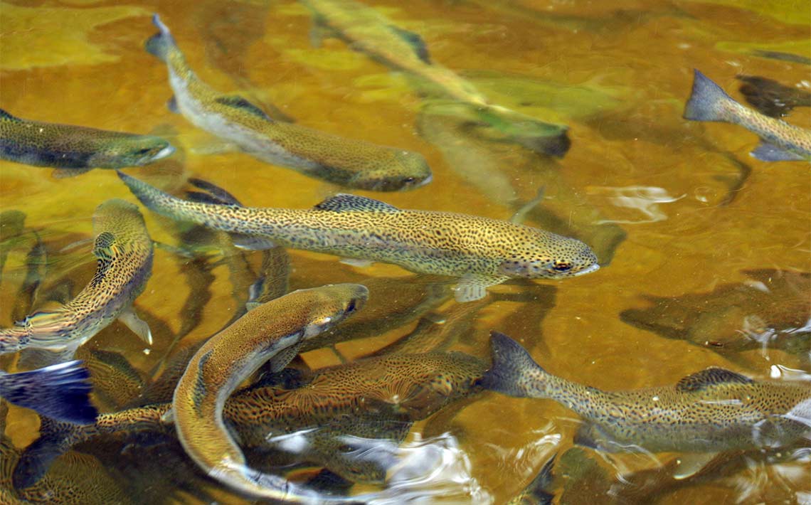
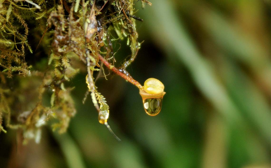
Trout farmed by a resident of San Andres, about 30 minutes from the main hamlet, as part of a project to preserve the forest on his land.PHOTO: Jonathan Palma
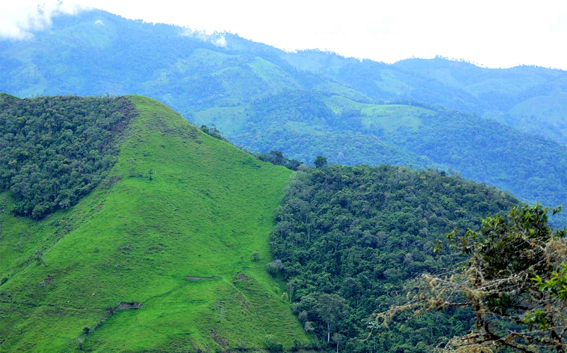
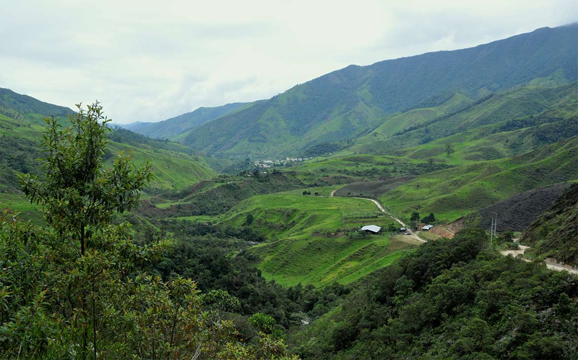
Panoramic view of the top of a mountain showing the remnants of forest in Zamora Chinchipe, eastern Ecuador.PHOTO: Jonathan Palma
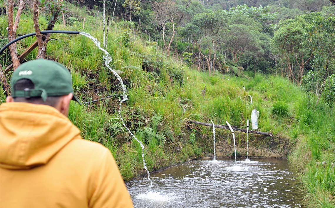
Trout pools that draw water from nearby springs in a forested area 30 minutes from the hamlet of San Andres.PHOTO: Jonathan Palma
A Muscovy Duck (Cairina moschata) in the Isimanchi River near San Andres, Zamora Chinchipe.PHOTO: Jonathan Palma
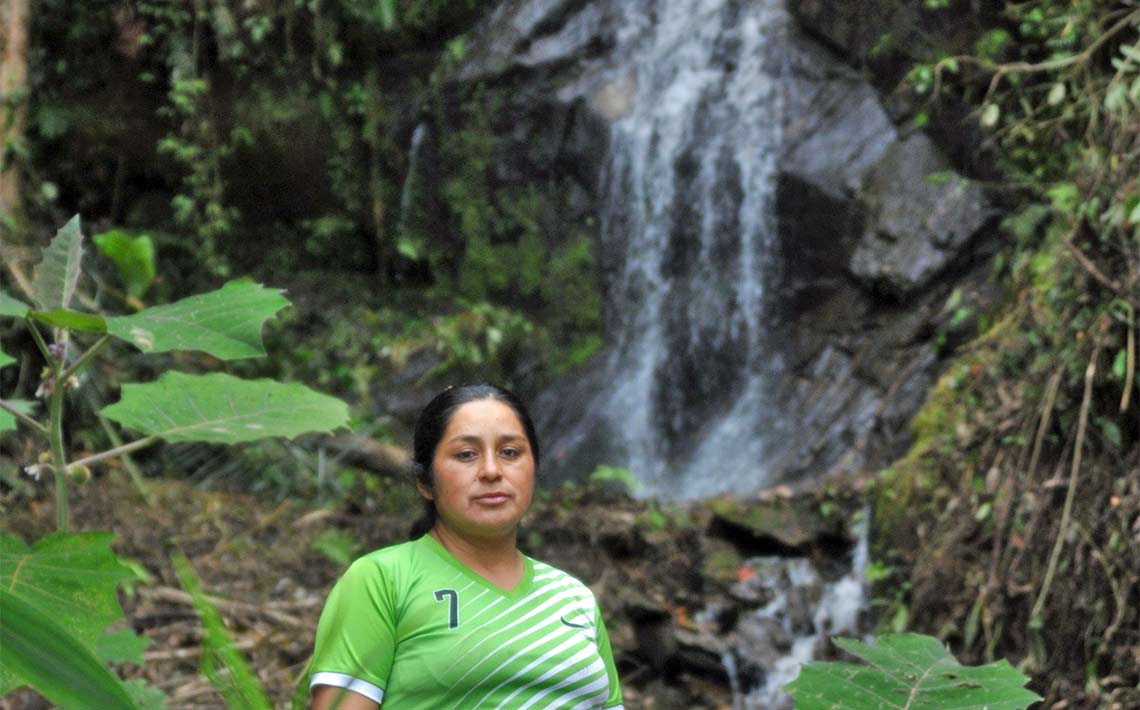
Marisol Calva, 40, is one of the residents of San Andres who decided to conserve about 150 acres of forest located 25 minutes from the hamlet of San Andres. PHOTO: Jonathan Palma
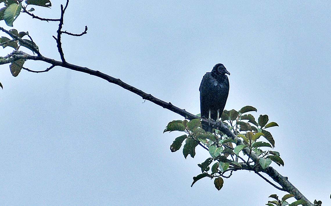
A black vulture (Coragyps atratus) looking at its environment in a tree at the foot of the Isimanchi River.PHOTO: Jonathan Palma
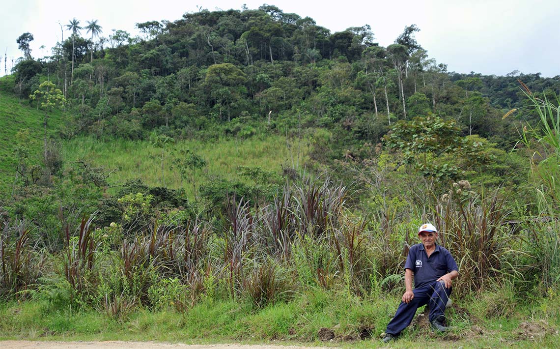
A resident of San Andres on the slopes of one of the mountains that surround the town.PHOTO: Jonathan Palma
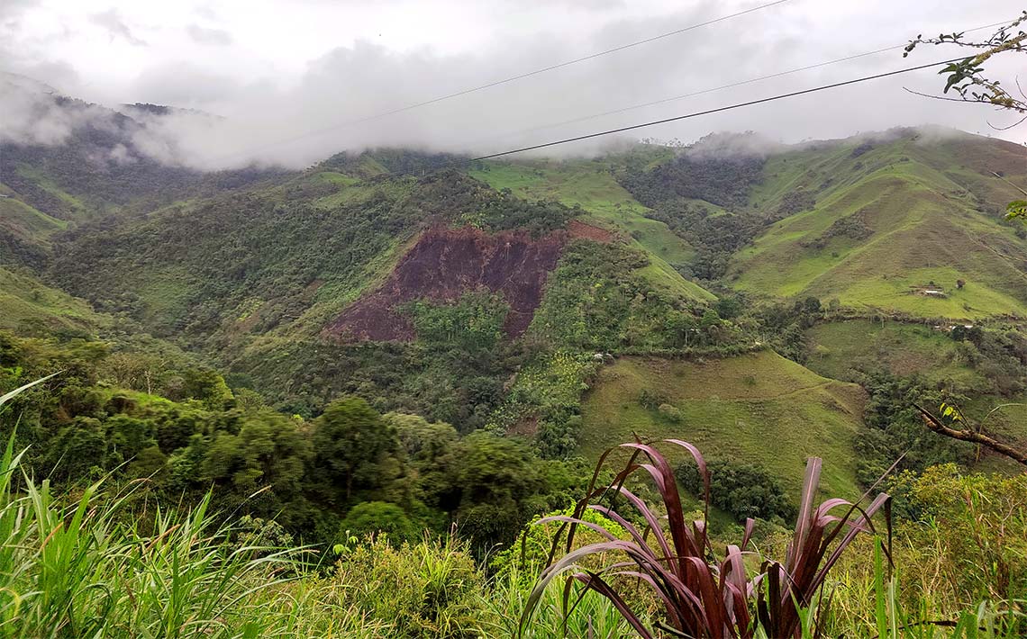
The route to San Andres is marked by black patches which are the result of logging and burning of vegetation by farmers to make room for cattle or other agricultural activities.PHOTO: Jonathan Palma
To combat illegal logging, authorities of the Ministry of Environment say they inspect shipments on the roads and at final destinations in Ecuador. According to government records, 262,388 cubic feet was seized in 2021; in 2022, 444,788 cubic feet was seized; and in 2023, 372,534 cubic feet was confiscated. In each of those years, the seizures occurred because the wood was illegally harvested or because the shipment did not have the required documents.
However, in the province of Zamora, seizures are scarce in 2023 -- just 141 cubic feet of wood was seized during 13 operations.
Amid the surge in illegal logging there are conservation efforts by organizations working to persuade land owners to preserve their forests. The Ministry of Environment singled out the efforts of the Socio Bosque and REDD+ Ecuador projects, which grants payments to those who preserve trees on their property or complete other conservation objectives established in a commitment with the owners of the forests.
The arrival of the transportation truck sparks excitement in the village. Elderly people and children peer from the windows of colorful wooden houses near a creek, as if waiting for someone or something to arrive. There are only two arrivals a day, in the morning and in the afternoon, and each one brings the promise of something new and unexpected.
The San Andres parish is home to some 460 people, according to the last health census of 2023. The residents describe the richness of the fauna they have seen over the years.
"The lions have been seen in the foothills," says Marisol Calva referring to pumas (Puma concolor). She lives along one of the main streets of San Andres and takes time out of her duties as a cleaner in the parish to tell us that there used to be more sightings of spectacled bears (Tremarctos ornatus), pumas, ocelots (Leopardus tigrinus), tapirs (Tapirus), and peccaries (Pecari tajacu), species that are on the international list of endangered or threatened animals.
"In the case of mammals, the living areas, that is, the areas where an individual will roam are huge. The larger the individual, the more areas it will need to live in," explains Diego Cisneros Heredia, professor of biology and director of the Institute of Tropical Biodiversity iBIOTROP of Universidad San Francisco de Quito.

Alouatta seniculus

Tremarctos ornatus
Tapirus pinchaque

Cervidae

Rupicola peruvianus

Puma concolor

Leopardus tigrinus

Pecari tajacu
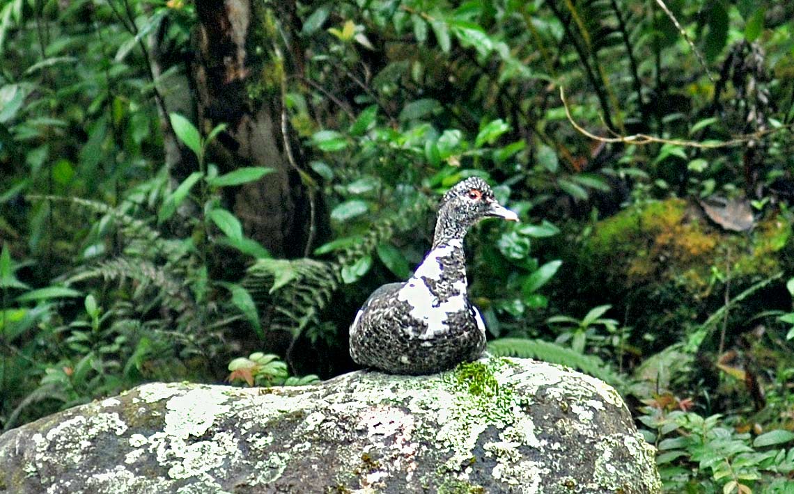
The bird population is another animal universe in San Andres, seen fluttering in the treetops and around trunks and hopping on branches of the trees. The colors of the birds blend with leaves and flowers. A flock of yellow-rumped caciques (Cacicus cela) jumps from one branch to another, restless and communicating with peculiar sounds. Woodpeckers (Lineated Woodpecker-Dryocopus lineatus) leave their marks in this biodiverse valley by making holes in tree trunks. This is only a glimpse at the 153 species registered by the provincial government in this area of Zamora Chinchipe.
Flora is also abundant in this part of eastern Ecuador, combining the characteristics of Andean and Amazonian landscapes. According to official records of the province, about 81 endemic species have been recorded in the area considered "high montane evergreen forest,” mostly belonging to the orchid family (Orchidaceae).
Against this backdrop of natural beauty, the gold rush is evident and growing. For the past four years, children, young people, adults, seniors, men and women have traveled to the Zamora Chinchipe to "janchear" -- the name given to the job of searching for gold in soil extracted by a dredge or dug from rivers with a pick and shovel. A person can earn $50 or more for each gram of gold, according to the kiosks that purchase the mineral.
Chito is one of the villages affected by illegal mining, which disguises itself as artisanal mining although its tools are industrial dredges, material conveyors and electric generators.
Revenues from illegal mining are high and so is the cost to nature. This activity has destroyed the riverbed of certain stretches of the Mayo River and the water has been contaminated by fuel used in mining machinery.
In San Andres, residents see a grim future reflected in the path taken by Chito and they watch for any activity along the Isimanchi River that crosses their parish. The water of this tributary, unlike others in the province, is crystal clear.
The pristine river attracts wildlife, sometimes species that are rarely seen. When a black and white Muscovy duck rested on the rocks, surprised villagers activated a natural areas surveillance protocol and sounded an alert. "We immediately notified the police," they said.
The residents of San Andres have opted for economic alternatives, such as trout farming, that depend on preserving a crystalline river.
These efforts have brought hope to local people but they have also brought challenges that weaken the already fragile economy. On a rainy afternoon in December, 45-year-old Wilman Jiménez, said he was having trouble finding a steady market for the trout he cultivates with a partner.
"Right now, we are stuck with the product,” he said. “There is a gap in the connection between the producer and the market.”
Jimenez called on organizations or the government to help producers find markets for their fresh fish. Jimenez and other farmers say they need training and technical assistance to prevent them from seeking alternatives that could damage the ecosystem.
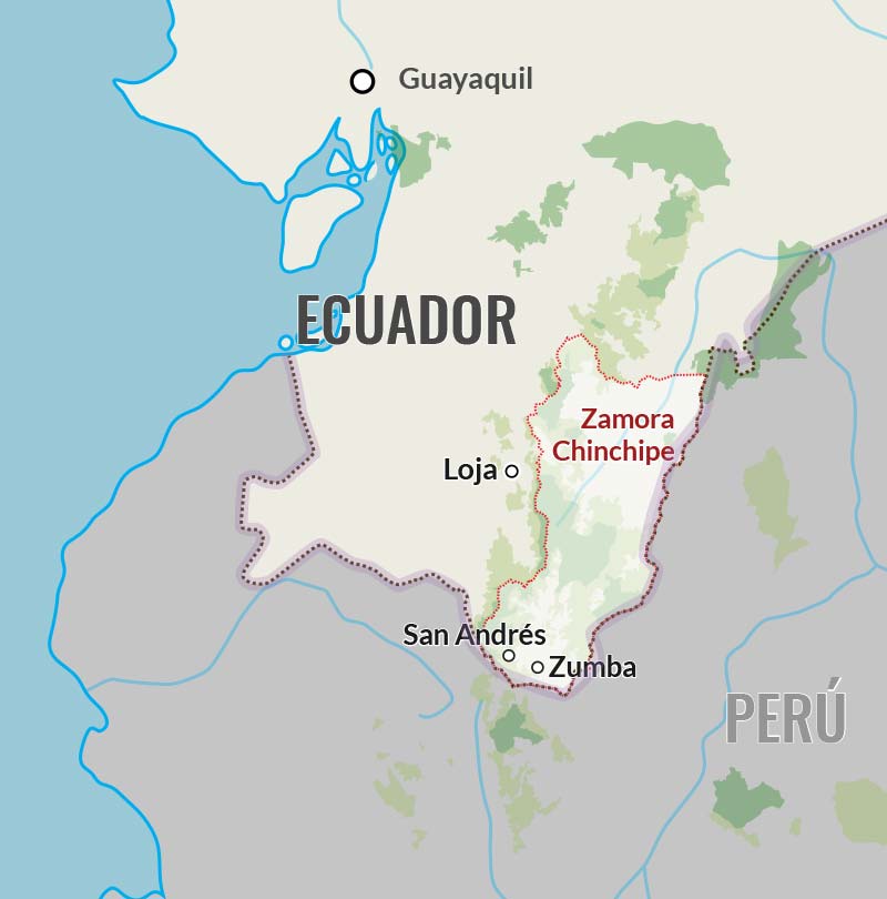
A drop of water slides down moss on the lower part of a tree near the Isimanchi River in Zamora Chinchipe.PHOTO: Jonathan Palma
Wilman Jiménez,45, removes the guts from a trout that he will share with his family. He raises fish as way of preserving his forest.PHOTO: Jonathan Palma
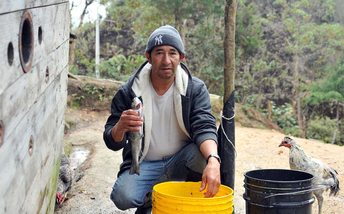
Two students from San Andres School at the end of the school day.PHOTO: Jonathan Palma
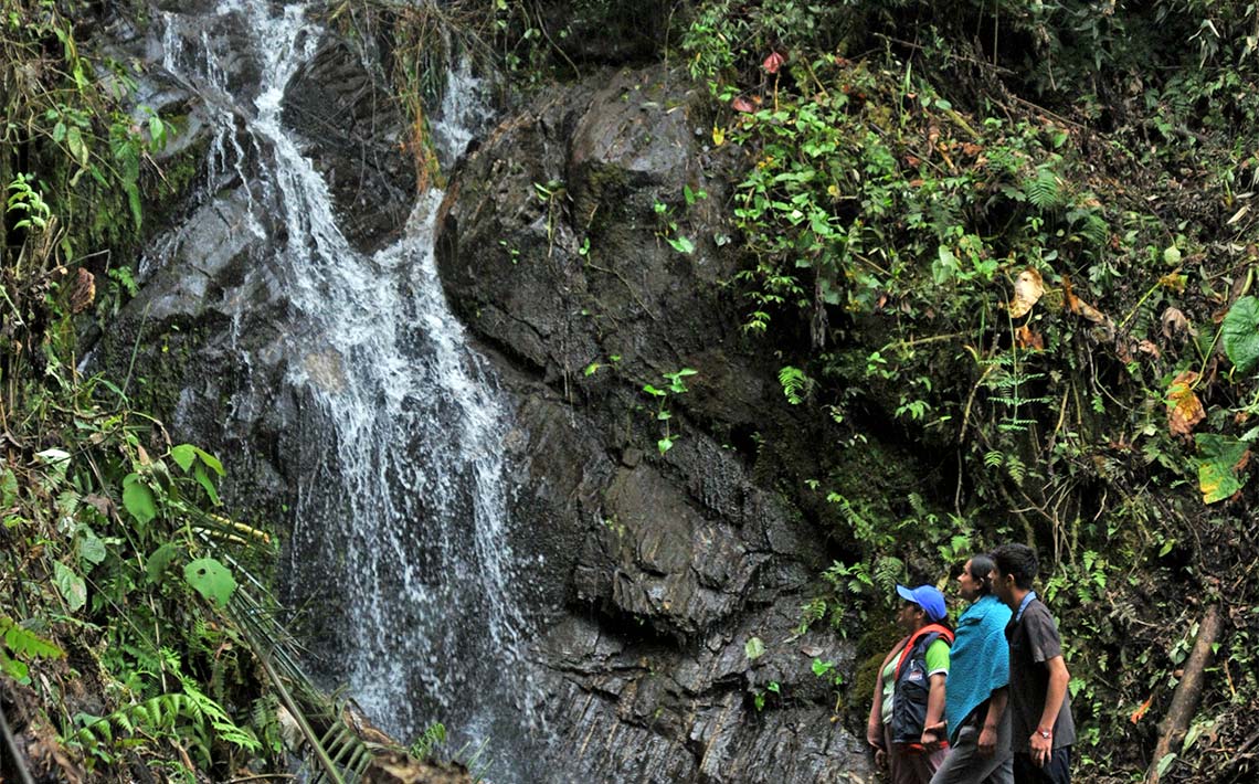
Marisol Calva and two of her three children walk along the waterfall that crosses their property in one of the mountains of San Andres, Zamora Chinchipe, eastern Ecuador.PHOTO: Jonathan Palma
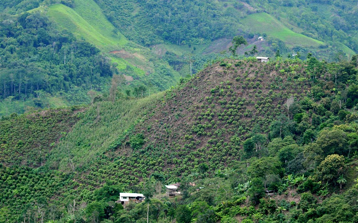
Crops have taken over the tops of the hills and mountains of Zamora Chinchipe, where there used to be tree cover.PHOTO: Jonathan Palma
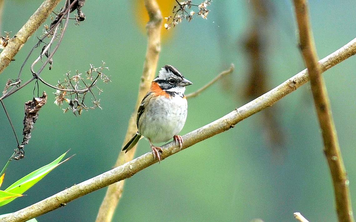
A specimen of Rufous-collared Sparrow (Zonotrichia capensis).PHOTO: Jonathan Palma
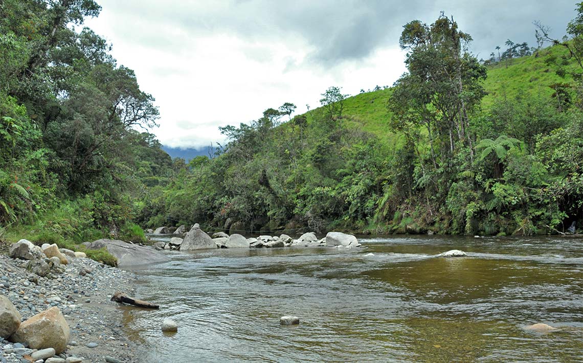
The Isimanchi River feeds the Mayo or Chinchipe River, which crosses the border and irrigates the Peruvian departments of Piura, Cajamarca and Amazonas, making it critical to protect the shared ecosystem.PHOTO: Jonathan Palma
Ecuador is regulated by the National System of Protected Areas (SNAP), comprised of more than 70 conservation zones, totaling more than 64 million acres (19% of the national territory under conservation). It includes private protected areas and protected areas of decentralized autonomous governments.
In San Andres, there are de facto protected areas defined by each resident on their own. At the same time, the Parish Council and the municipality of Chinchipe have formally promoted environmental protection initiatives.
In 2010, the San Andres Municipal Conservation Area was created through an ordinance that incorporated almost 12,000 acres. Twelve years later, at the end of 2022, the area was expanded to more than 86,000 acres to include another reserve, the Municipal Conservation and Sustainable Use Area of Cantón Chinchipe.
"Our goal is for the area to belong to the National System of Protected Areas, which will guarantee us better protection," explains Diego Abad, president of the San Andres Parish Council.
But that goal could take longer than expected.
"It is very bureaucratic, because of the constitutional importance of considering an area as protected," explains Cristina Melo, coordinator of the Human Rights and Rights of Nature Program of The Pachamama Alliance, which assists ancestral communities in the creation and protection of reserves.
On the other hand, the lawyer highlights the local initiatives that have established protection points or areas, which could add up to large swaths of forest and, in turn, encourage more farmers, ranchers and communities to create biological corridors.
As residents of the San Andres Valley safeguard their forests, a wildlife corridor is slowly developing along the border of Ecuador and Peru.
Nature and Culture International (NCI), which provided technical support in the creation of the San Andres reserve, is also collaborating with the two countries in the Andean Connectivity Corridor project, which seeks to protect more than 2.4 million acres between Ecuador and Peru.
The project was conceived in 2019 by mutual presidential declaration. According to the Ecuadorian Ministry of Environment, in 2022 the number of acres belonging to both nations and the respective percentages corresponding to the conservation units that will integrate the corridor were established.
Work is planned this year to validate or readjust the boundaries, develop a management model proposal and an action plan for 2024 with local stakeholders and institutions.
While these details are being worked out in offices hundreds of miles away from the natural areas, in the wild, on hillsides and riverbanks, the eyes and ears of Esther, Marisol, Wilman and José will remain vigilant for any risk that might threaten the micro forests.